Project information
- Category: Web App
- Project date: Jan 2022 - Dec 2023
- Data Source: Denton LiDAR, UNT GIS Data
- Tool Used: ArcGIS Pro (3D Basemap Solution, Spatial Analyst), ArcGIS Online
- Web App URL: UNT Digital Twin
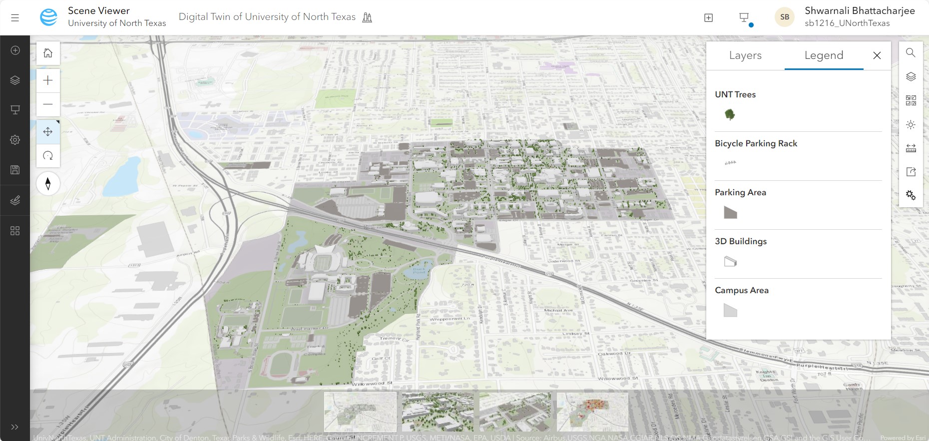
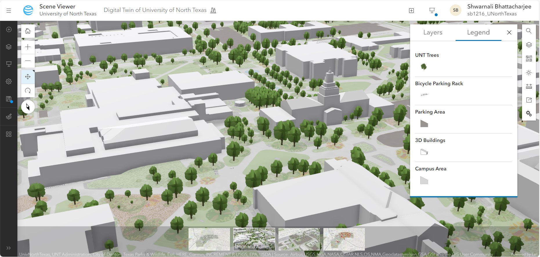
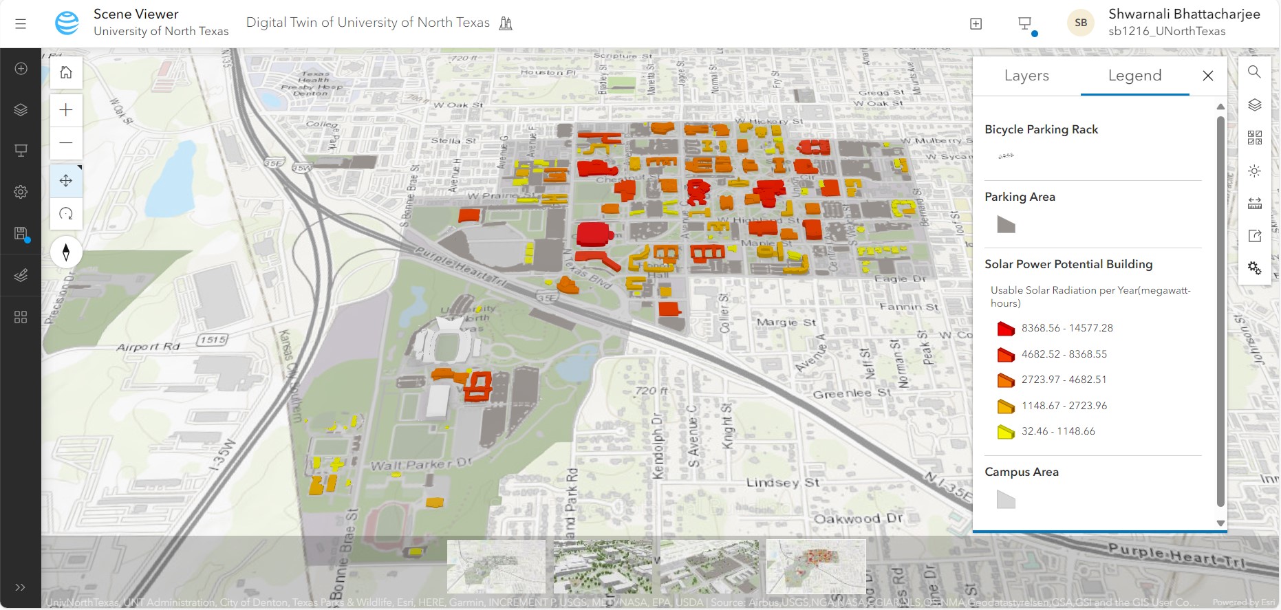
This project displays a digital twin of the University of North Texas (UNT) using LiDAR and GIS data in ArcGIS Online Scene Viewer. LiDAR point clouds are used to create 3D building and vegetation modeling along with other GIS data (bicycle racks and parking area) in creating digital twin model. 3D basemap solutions of ArcGIS Pro and ArcGIS Online Scene Viewer, respectively, are used to create an initial 3D urban model and build the ultimate digital twin of UNT. The emergency management plan of UNT is incorporated into the digital twin to increase emergency management efficiency. Solar power potential for individual buildings at UNT has been estimated using the Digital Surface Model (DSM) and integrated into the digital twin model to identify the buildings with the highest solar energy capacity.